Search -
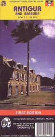
Antigua and Barbuda Map (Travel Reference Map)
Antigua and Barbuda Map - Travel Reference Map
Author:
Travel map of the islands in color. Color changes show elevations. Shows roads from major roads to gravel roads and footpaths; airports and landing strips; bus stations; points of interest; accommodations; beaches; reefs; golf courses; churches; schools. Latitude/longitude grid. With inset maps of City of St. John's, English Harbor, Barbuda, Car... more »
ISBN-13: 9781553411291
ISBN-10: 1553411293
Publication Date: 1/2003
Pages: 1
Rating: ?
ISBN-10: 1553411293
Publication Date: 1/2003
Pages: 1
Rating: ?
0 stars, based on 0 rating
Genres:


