We see that javascript is disabled or not supported by your browser -
javascript is needed
for important actions on the site.
Read more
Skip to main content
What's New
-
Home
-
Login
Member $avings: $
81,773,649.43
|
Books Available:
721,649
|
Members Online: 255
Swap Used Books - Buy New Books at Great Prices!
How To Swap Books
Sign Up
Search
All Books
PBS Market (New Books)
Gift Buying Guide
Book Browser
Advanced Search
Books Posted Today
Member Book Reviews
Award Winning Books
NYT Best Sellers
Amazon Best Sellers
Most Traveled Copies
Club Wish List
Login
Community
Discussion Forums
Book Lists
Club Lists
My Book Lists
My Watched Lists
Create a List
Blog
Donations
School Donation Program
In Memory of...
Military Donation Program
Friends of PBS
Box-O-Books
Maps
The Eclectic Pen
Fun Stuff
20 Questions
Sudoku
Bookmark Creator
Top 100
Wishes
Requests
Posts
Swappers
Referrers
Reviewers
Pulse of PBS
Spread The Word
Invite Friends
Bookmarks
Facebook Page
Facebook App
More Ways...
Photo Gallery
Recipes
Club Tag Cloud
Member Testimonials
Help Center
How To Swap Books
Browse Help Docs
Ask the Librarian
PBS Member Icons
Live Help
Kiosk
PBS Market (New Books)
Go Shopping
Buy Credits
Buy PBS Money
Upgrade Membership
Gift Certificates
Transfer Credits
Need Help?
Visit the Help Center
-
Close X
How to Swap Books
Sign Up
Login
Community
Help Center
Kiosk
Want fewer ads?
Search
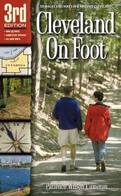
- Cleveland On Foot 3rd Edition
Cleveland On Foot 3rd Edition
Author:
Patience Cameron Hoskins
: Do not stray too close to the edge of this cliff. Erosion here has created uneven footing and unstable soil. 5.Ê(0.8 mile). As you pass the Bridle Trail sign (hanging by one bolt at this writing!), turn right toward TinkerÕs Creek gorge and continue on the trail. The road on the left is the north portion of Button Rd., which no longer conne
...
more »
cts to the southern part. Button Rd. is of interest because it is one of the oldest roads in northern Ohio. It was laid out in 1801 and enabled early settlers living in the highlands to the east of here to reach the Ohio & Erie Canal lying to the west. 6.ÊContinue on this flat, winding, woodland path high above TinkerÕs Creek. Several short side trails veer over closer to the cliff edge, but always return to the main trail. (Use CAUTION if you take these side paths for more views of the gorge below.) At about 1.2 miles the trail begins a gradual descent. 7.ÊReach a trail intersection after another 0.2 mile. Turn right (east) toward the gorge. In another 0.1 mile reach the top of a small hill and another beautiful view of the gorge. Step to the edge for another view amidst the hemlocks. This is the turnaround point for this hike. Beyond this point, the former trail is closed due to neglect and is barely used. You will return to Hemlock Creek Picnic Area by following the trail in reverse. This chapter was reviewed and rewalked by Jim Sprague, statewide trail coordinator of the Buckeye Trail Association. Copyright © Patience Cameron. All rights reserved. This text may not be reproduced in any form or manner without written permission of Gray & Company, Publishers
« less
Post This Book
Login | Register
ISBN-13:
9781886228153
ISBN-10:
1886228159
Pages:
285
Edition:
3rd
Rating:
?
0
stars, based on
0
rating
Publisher:
Gray & Company Publishers
Book Type:
Paperback
Members Wishing:
1
Reviews:
Amazon
|
Write a Review
Want fewer ads?