Search -
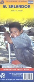
El Salvador Map by ITMB
El Salvador Map by ITMB
Author:
Folded paper road and travel map in color. Scale 1:250,000. Distinguishes roads ranging from main highways to other roads. Legend includes trails/tracks, railways, national boundaries, provincial/terrtorial boundaries, National Parks, international airports, domestic aerodromes, points of interest, churches, major archaeological ruins, other arc... more »
ISBN-13: 9781553411987
ISBN-10: 1553411986
Publication Date: 9/1/2006
Pages: 1
Edition: 3
Rating: ?
ISBN-10: 1553411986
Publication Date: 9/1/2006
Pages: 1
Edition: 3
Rating: ?
0 stars, based on 0 rating
Publisher: International Travel Maps and Books
Book Type: Map
Members Wishing: 0
Reviews: Amazon | Write a Review
Book Type: Map
Members Wishing: 0
Reviews: Amazon | Write a Review
Genres:
- Reference >> Atlases & Maps >> World
- Travel >> Travel Writing
- Travel >> Latin America >> Central America >> El Salvador
- Travel >> Latin America >> South America >> General


