Search -
Erie, Pa (City Wall Maps)
Erie Pa - City Wall Maps
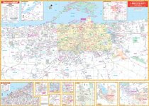
The 2009 edition Erie, Pennsylvania Wall Map by Universal Map measures 63 x 46 (5'3 W x 3'10 H) and is complete street detail at a scale of 1 = 960 feet. Area of coverage ranges: North: to Lake Erie, including Presque Isle State Park; South: includes the I-90 and I-79 interchange, and Orchard Ponds Golf Course; East: to Harbor Creek and SR 531 a... more »
The 2009 edition Erie, Pennsylvania Wall Map by Universal Map measures 63 x 46 (5'3 W x 3'10 H) and is complete street detail at a scale of 1 = 960 feet. Area of coverage ranges: North: to Lake Erie, including Presque Isle State Park; South: includes the I-90 and I-79 interchange, and Orchard Ponds Golf Course; East: to Harbor Creek and SR 531 a... more »
ISBN-13: 9780762511990
ISBN-10: 0762511990
Rating: ?
ISBN-10: 0762511990
Rating: ?
0 stars, based on 0 rating
Publisher: Universal Map Enterprises
Book Type: Paperback
Members Wishing: 1
Reviews: Amazon | Write a Review
Book Type: Paperback
Members Wishing: 1
Reviews: Amazon | Write a Review


