Search -
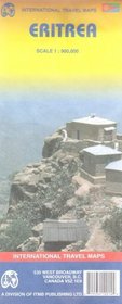
Eritrea Map by ITMB
Eritrea Map by ITMB
Author:
Folded paper road and travel map in color. Scale 1:900,000. Distinguishes roads ranging from primary paved roads to tertiary roads (unpaved motorable). Legend includes international boundaries, National Parks/reserves, forests, dunes, railroads, tracks, international airports, national airports, gas stations, bus stations, hospitals, embassies, ... more »
ISBN-13: 9781553412014
ISBN-10: 155341201X
Publication Date: 9/1/2006
Pages: 1
Edition: 3
Rating: ?
ISBN-10: 155341201X
Publication Date: 9/1/2006
Pages: 1
Edition: 3
Rating: ?
0 stars, based on 0 rating
Publisher: International Travel Maps and Books
Book Type: Map
Members Wishing: 0
Reviews: Amazon | Write a Review
Book Type: Map
Members Wishing: 0
Reviews: Amazon | Write a Review
Genres:
- Reference >> Atlases & Maps >> Travel Maps
- Reference >> Atlases & Maps >> World
- Travel >> Africa >> Eritrea
- Travel >> Africa >> General
- Travel >> Travel Writing


