Search -
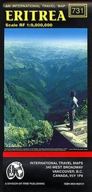
Eritrea Map
Eritrea Map
Author:
Scale 1:900,000. With inset map of Asmara. Printed on one side. Map of the country and portions of its neighbors. With topographical contours; elevations indicated by color changes. Legend locates roads (with point-to-point distances in kilometers) from primary paved roads to tracks; railroads; airports and airfields; bus stations; post office... more »
ISBN-13: 9780921463733
ISBN-10: 0921463731
Publication Date: 1/1/1997
Pages: 1
Reading Level: Ages 9-12
Rating: ?
ISBN-10: 0921463731
Publication Date: 1/1/1997
Pages: 1
Reading Level: Ages 9-12
Rating: ?
0 stars, based on 0 rating
Genres:


