Search -
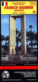
French Guiana Map
French Guiana Map
Scale 1:500,000. With inset maps of Kourou (1:15,000) and Cayenne (1:13,000). Printed on one side. Map of the country with topographical contours; elevations indicated by color changes. Legend locates international and district boundaries; settlements from major cities to villages; roads from primary roads to cart tracks or trails; bus sta... more »
Scale 1:500,000. With inset maps of Kourou (1:15,000) and Cayenne (1:13,000). Printed on one side. Map of the country with topographical contours; elevations indicated by color changes. Legend locates international and district boundaries; settlements from major cities to villages; roads from primary roads to cart tracks or trails; bus sta... more »
ISBN-13: 9781895907728
ISBN-10: 1895907721
Publication Date: 6/30/1998
Pages: 1
Edition: 1
Rating: ?
ISBN-10: 1895907721
Publication Date: 6/30/1998
Pages: 1
Edition: 1
Rating: ?
0 stars, based on 0 rating
Publisher: International Travel Maps
Book Type: Map
Members Wishing: 0
Reviews: Amazon | Write a Review
Book Type: Map
Members Wishing: 0
Reviews: Amazon | Write a Review
Genres:
- Reference >> Atlases & Maps >> Travel Maps
- Travel >> Europe >> France >> General
- Travel >> Travel Writing
- Travel >> Latin America >> South America >> French Guiana, Guyana & Suriname


