Search -
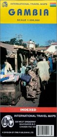
Gambia Map by ITMB
Gambia Map by ITMB
Author:
Folded road and travel map in color. Scale 1:350,000. Distinguishes roads ranging from primary paved roads to other roads/tracks. Legend includes distric boundaries, National Parks, ferry routes, rialroads, international/national airports, aerodrome/landing fields, bus stations, gas stations, points of interest, ruins/archeological sites, forts/... more »
ISBN-13: 9781553412175
ISBN-10: 1553412176
Publication Date: 6/1/2003
Pages: 1
Rating: ?
ISBN-10: 1553412176
Publication Date: 6/1/2003
Pages: 1
Rating: ?
0 stars, based on 0 rating
Publisher: International Travel Maps and Books
Book Type: Map
Members Wishing: 0
Reviews: Amazon | Write a Review
Book Type: Map
Members Wishing: 0
Reviews: Amazon | Write a Review
Genres:


