Search -
The Guianas Map
The Guianas Map
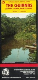
Map of Guyana, Surinam, and French Guiana with portions of Brazil and Venezuela. Elevations shown by color changes and numbers on map. Legend locates international and district boundaries; legal border crossing points; settlements from major cities to villages; roads from primary roads to cart tracks/trails; railways; bus stations; car rental; ... more »
Map of Guyana, Surinam, and French Guiana with portions of Brazil and Venezuela. Elevations shown by color changes and numbers on map. Legend locates international and district boundaries; legal border crossing points; settlements from major cities to villages; roads from primary roads to cart tracks/trails; railways; bus stations; car rental; ... more »
ISBN-13: 9781895907681
ISBN-10: 1895907683
Publication Date: 1/1/1999
Pages: 1
Rating: ?
ISBN-10: 1895907683
Publication Date: 1/1/1999
Pages: 1
Rating: ?
0 stars, based on 0 rating
Publisher: International Travel Maps
Book Type: Map
Members Wishing: 0
Reviews: Amazon | Write a Review
Book Type: Map
Members Wishing: 0
Reviews: Amazon | Write a Review
Genres:
- Reference >> Atlases & Maps >> Travel Maps
- Travel >> Latin America >> South America >> French Guiana, Guyana & Suriname


