Search -
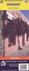
ITMB Uruguay Map with Montevideo City Plan
ITMB Uruguay Map with Montevideo City Plan
Author:
Travel map with highways and roads and places of interest. Elevations shown by color changes. Includes an index of places. Differentiates five levels of roads including highways, roads, gravel roads and rough gravel roads. Includes road numbers, distances shown in kilometers, toll posts. Bridges, railways and railway stations, ferries, airport... more »
ISBN-13: 9781553414520
ISBN-10: 1553414527
Publication Date: 2/2004
Pages: 1
Rating: ?
ISBN-10: 1553414527
Publication Date: 2/2004
Pages: 1
Rating: ?
0 stars, based on 0 rating
Genres:


