Search -
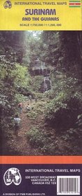
Surinam and the Guianas Map (Travel Reference Map)
Surinam and the Guianas Map - Travel Reference Map
Author:
Map of the countries and portions of their neighbors. Elevations shown by color changes and numbers on map. Legend locates international and district boundaries; legal border crossing points; settlements from major cities to smaller settlements; roads from primary roads to cart tracks/trails; railways; bus stations; airports and airfields; fe... more »
ISBN-13: 9781553414155
ISBN-10: 1553414152
Publication Date: 1/1/2003
Pages: 1
Edition: 2nd
Reading Level: Ages 4-8
Rating: ?
ISBN-10: 1553414152
Publication Date: 1/1/2003
Pages: 1
Edition: 2nd
Reading Level: Ages 4-8
Rating: ?
0 stars, based on 0 rating
Publisher: International Travel Maps
Book Type: Map
Members Wishing: 0
Reviews: Amazon | Write a Review
Book Type: Map
Members Wishing: 0
Reviews: Amazon | Write a Review
Genres:
- Children's Books >> Ages 4-8 >> General
- Reference >> Atlases & Maps
- Travel >> Latin America >> South America >> French Guiana, Guyana & Suriname


